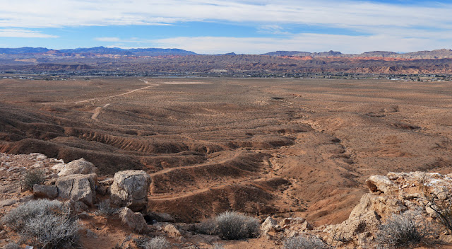
The historic Mormon Mesa Road, which used to run from Overton to Mormon settlements to the east. Before that, it was part of the Old Spanish Trail. This was taken from atop Mormon Mesa.

From up on top of the mesa, looking north -- the ridge of Mormon Mesa, the east side of the Moapa Valley, and the Mormon Mountains to the right.
Taken with a 100-400 lens, so "objects appear closer than they really are", this is a telephoto view of the Mormon Mountains.
Looking to the west, the Moapa Valley town of Logandale and the snow-dusted Sheep Range.
From near to far -- Overton, the flat top of Overton Mesa, the Valley of Fire, and the Muddy Mountains, looking southwest.
A wide-angle view of Overton, Logandale and the Moapa valley from Mormon Mesa.
A panoramic look at Overton, the Valley of Fire, and the Muddy Mountains.
Using the 500mm long-distance telephoto lens and looking northeast, here's the Beaver Dam Mountains in SW Utah -- again, a compressed view.
The Virgin Mountains to the east, with 8,075 foot Virgin Peak in the middle.
A 4-photo panorama from the east side of Mormon Mesa of the Virgin Valley and Virgin Mountains.
An hour before sunset -- Virgin Peak.
The late-afternoon shadows lengthen at Mormon Mesa, looking northwest.
The Mormon Mountains and 6,071-foot Moapa Peak.
A closeup of Moapa Peak.
A section of the desert mountains to the southeast.
The full, panoramic view of the desert mountains on the other side of Lake Mead, near sunset.
Last light on the Virgin Mountains -- and also on Tundra II.
The Virgin Mountains at sunset, from Mormon Mesa.
And now those wild, untamed birds at the Overton Wildlife Management Area --
Mr. Lesser Goldfinch.
And the missus.
A Western Meadowlark fluffing out his feathers.
Loggerhead Shrike.
And Ms. Northern Harrier.
And you can see, it's still mostly wild, untamed, and primeval here on the northern arm of Lake Mead..


No comments:
Post a Comment