A saying I use a lot these days is "Tempus Fugit" -- Latin for "Time Flies". And it sure seems like it's been "fugiting" more than ever lately as I head up north to Alaska. Hard to believe I've already been on the road for over 3 weeks, and in the process driven about 3500 miles. And I'm still about 2000 miles from Anchorage...So to catch up, here's a short summation of the trip from Nevada's Elko and the Ruby Mountains to today, when I'm at Brookside RV Park in Cache Creek, British Columbia.
While in northern Nevada, exploring the Ruby Mountains south of Elko, I stayed at at the Elko RV Park in Lyndon, about 12 miles east of Elko off Interstate 80. It has shade trees (rare in this area), WiFi, showers, laundry, propane, and a small "casino" and bar, the last two which seem to be ubiquitous even in the smallest hamlets in Nevada. Megan and Jan run the desk in the office. A nice, friendly outfit, and one I can heartily recommend as it's far enough to be out of Elko, yet close enough to do your shopping at the Wal-Mart there.

Of course, the main attraction are the Ruby Mountains, just south of Elko. They're an anomaly in Nevada -- a mountain range much like the Sierra Nevada, carved by glaciers. They've been termed "The Swiss Alps of Nevada", and for good reason. Here's one of the unique features to be found there -- a "hanging valley".

And Mt. Fitzgerald, named after JFK, looking very alpine like with its valley.

Lamoille Valley is a textbook example of a glacially-carved valley; it's been called "The Yosemite Valley of Nevada". As you drive along the paved road that goes through the valley, you're surrounded by mountains rising thousands of feet above you. This is the view from the trail over Liberty Pass, looking north.

At the end of the road through the valley is the trailhead that leads south to the backcountry of the Rubies. I did a day hike over Liberty Pass, and this is the view of the other side. It's amazing when you think of the popular conception of Nevada -- hot, dry desert. This looks more like California's Sierra Nevada. That's Liberty Lake, considered by some to be the most picturesque in all of Nevada.

The main reason for my visiting the Rubies -- well, besides the fact that I wanted to -- was to see Himalayan Snowcock, a game bird native to high mountain regions of Pakistan. They were transplanted to the Rubies about 50 years ago, and are a top bird to see in the US as they're only found here. However, they're hard to see as they're only found in high elevations. Most people who are looking for the bird hire out helicopters to find them; I opted to find them from the ground I knew where they've been reported having been seen, and it's only about 1.5 miles from the main paved road through Lamoille Valley, so I took all of the equipment you see below, including my 500mm lens, and backpacked in to find them.

The hiking trail goes up to Island Lake, which sits in a cirque in one of the canyon walls enclosing Lamoille Valley. I took this photo from atop a bench just north of the lake, where I made my campsite.

Here's my campsite, with the spotting scope aimed at the cliff faces where I hoped to find the Himalayan Snowcocks. And on the second day, I did. I first heard them calling, then saw 2 Snowcocks flying high up the cliff face to the top right. I saw them for only about 5 seconds at most, and wasn't able to take a photo -- but I definitely heard and saw the birds. That morning there had been a group of about 4 birders who spent a good part of the morning looking for the birds; they never found them. Since I was camping there and could wait the Snowcocks out, I did.

The Snowcocks were the main reason for the backpack, but there is another species that was transplanted to the Rubies -- mountain goats. And they too had been seen in this area. I did eventually see them, in the evening of the same day I saw the Snowcocks. They were about as far from me as the birds, though not quite up as high on the cliff faces. However, my 500mm lens came in handy as I would not have been able to get any of the following shots with anything less. And one particular situation was quite touching -- and literally ended up as a "cliffhanger". There was the mountain goat family -- Mom, Dad, and "Junior". Here they are, doing what mountain goats do, climbing up a narrow ledge up the face of a cliff --

They were doing fine until Junior stopped on a rock slab and seemed unable to go any further. One of the parents looked back --

And -- Mom? -- laid down and, in this photo, looks like she was giving him encouragement to get across --

But the last I saw of them, Junior had disappeared, and it was just the parents. I looked below where they were, dreading that I'd find a white lump -- but saw nothing. I was hoping that he'd found another way to make it across, and friends who are knowledgable about mountain goats assured me they're very agile, even at a young age, so he was probably fine. Though I still wish I'd seen him afterwards...
The trail up to Island Lake was a wildflower spectacle; residents told me it was a very wet spring --

Here's the canyon wall up which Island Lake is located; it's behind the bottom of the "V". And my campsite was to the left of the peak on the right.

By this time, it was nearly 3 weeks into the trip, and I was still a long way from Alaska, so I skedaddled up to my next destination -- Montana, and the and the ranch of my friend Jan Roat. She lives in Grass Range, in the middle of the state. I stayed at the Little Montana Truck Stop --
Where Jan and her daughter Paula have a cafe -- The Little Montana Chuckwagon. If you're ever in that area, this is the place to eat. Try the chicken fried steak, though you can't go wrong with pretty much everything on the menu. Paula is on the left, and Jan on the right --

I went out to visit Jan and her son Dan at their ranch, located on a dirt road about 8 miles from the paved highway. Roat Ranch is 1400 acres, and during a drive with Jan in her 4WD Ford Ranger pickup, we saw deer and a herd of at least 30 elk. Bears have been seen on her land occasionally, too.

My friend Paula, Jan's daughter, told me during one of the evenings there about a possible memorable sunset. I climbed the hill opposite the Little Montana Truck Stop where I was staying -- and she was right.

I spend 4 days visiting with Jan and her family in Grass Range; I'm planning on returning when I head back south in a few months' time. On my way to the Canadian border, I saw this piece of "local art" along the highway; I found out on Facebook, after posting the photo, that it had been an entry in a hay festival. It's a unique representation of Medusa...

Just before I crossed the border into Canada at the Del Bonita border station, I spent the night at the Cut Bank, MT info center's parking lot. It actually wasn't too bad, though I did get stuck in a funeral procession while trying to find it. I guess it must have been my having my headlights on that made me look like an attendee.

Oh Canada...I had no problems crossing the border at Del Bonita in the province of Alberta -- and I was the only vehicle waiting to get in. Though I'd checked on the Internet for the documents I needed to cross (passport, license, car and trailer registration) the officer just asked for my passport. He asked if I had any fruits or vegetables, and I responded by holding up by Zip-loc bag of mini carrots. I got a smile out of him with that...I don't think it will be as easy going back into the States; there were rumble strips and a concrete maze before the US station, even in a lightly-used outpost like Del Bonita.
I exchanged some money, headed in the direction of Calgary, took a loop to avoid it -- and ended up in a mini traffic jam on Canada Hwy 1, going into the Canadian Rockies. It turned out that day was the beginning of the Civic Day 3-day holiday weekend. All of the campsites were full. I did manage to get this photo along the highway going through Banff Nat'l Park of the magnificent scenery there. But I had to get out of there to have any chance of finding a place for the night. I'll be visiting Banff and Jasper on the way back south...

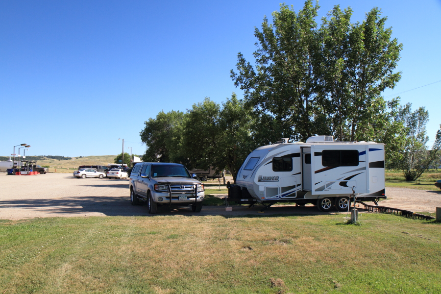
I eventually ended up staying in yet another parking lot, this time near the municipal campground in Golden, British Columbia. The next day, Saturday, it seemed like every Canadian had their campsite for the next 3 days, so I headed west to Cache Creek, which would lead me on the road north to Prince George and the route I was taking to Alaska. It turned out the RV park I had in mind had spots available, and I've been here for 4 days now, getting ready for tomorrow the 3rd, and Part II of the journey of North To Alaska. I've been doing day trips with Tundra in between tasks. Here's Kamloops Lake, about 30 miles east of Cache Creek. This area of British Columbia, the "interior south", is high desert -- sagebrush, cactus and rolling countryside dotted with pockets of pine trees. Most people find it surprising that this landscape, so reminiscent of Washington and Oregon east of the Cascades, is in Canada.

But about 30 miles or so west of Cache Creek, there's the heavily forested areas with rushing creeks (though this is more of a river, yet it's Cayoosh Creek) that looks more "Canadian".

Another day trip with Tundra was to the country south of Kamloops. I was surprised to see it's an area of lakes, a chain of bodies of water that runs south. Here's one of them --

Last night's sunset in the hills behind the RV park was memorable, with wind-whipped clouds presaging the rain we're having today, August 2nd --


Tundra and Discovery are now ready, and tomorrow it's on to Prince George and the start of the real North To Alaska...

No comments:
Post a Comment